Sports
A Mountain In Transition: Hiking Mount Baldy in Spring
This week's hike in the San Gabriel Mountains focuses on Mount Baldy and its unique spring landscape.


With a summit elevation beyond 10,000,’ Mount Baldy (aka Mount San Antonio) is one of the most scenic and well-known peaks in the Los Angeles region. In the winter, Mount Baldy becomes a winter wonderland, with its array of skiing, ice climbing, and various other winter mountaineering activities. In the summer, Mount Baldy attracts day-hikers in search of steep grade and unparalleled views of Southern California visible at its windblown summit. But what is Baldy like in Spring?
My friend, Jason, and I pursued an answer to this question last Wednesday morning. We parked at Manker Flats, a common parking area for hiking on Baldy, and began hiking up Falls Road. After a half-mile, we broke off from the fire road and began a trek up the popular Ski Hut Trail (aka Mount Baldy Trail). After about two miles, our journey met up with the Sierra Club Ski Hut and a spring-fed creek. On weekends, this spot is very popular but on this Wednesday afternoon, there were no other hikers visible whatsoever; the solitude was invigorating.
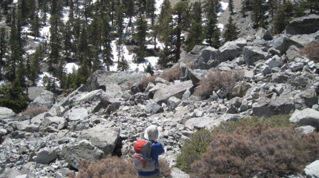
After filtering some water and consuming some snacks, we trudged onward, into the rock garden. Just past this rocky area, Jason and I encountered our first snow. The thick blanket of winter remnant obscured our trail and forced us to ascend steeper terrain. After a half-mile of post-holing, we came upon Resting Ridge, an odd plateau. Furthermore, the snow also disappeared just as quickly as it has appeared. We ascended another mile up in snow-free and exposed terrain.
Find out what's happening in Altadenawith free, real-time updates from Patch.
Finally, around 9600’, we could see the summit of Baldy, just beyond another steep field of icy snow. However, at this point, we were so close to the summit that very little could deter us from reaching the top. We dug in, gritted our teeth, and ascended up, up, and up, until finally, we came upon the snowy, cool summit of Los Angeles’ famed pinnacle.
Above 10,000 feet, the air tastes sweet; the pride of conquering a difficult, technical mountain feels even better. I savored this moment and took in the surreal beauty of Baldy’s odd summit. After 30 minutes of rest, we descended the sketchy Devil’s Backbone Trail, back to Manker Flats to close out an invigorating 12-mile hike through a sub-alpine mountain in seasonal transition.
Find out what's happening in Altadenawith free, real-time updates from Patch.
Distance 12 miles roundtrip Scenery This hike consistently overlooks Baldy Village and beautiful pine landscapes. Best time to go:
July through October are the easiest times to summit Baldy. November through May or June hikes typically require some experience and technical expertise for snow and ice.
Trail condition: Normally the trail is well-maintained. However, when snow is involved, the trail is easily lost. Right now this is not a trail for a beginner. Other considerations: The stream at the Ski Hut is the last source of water on this trail (but bring a filter to guarantee that this water is safe to drink!). Trekking poles are always a good idea but especially on this hike.Getting there:
Take the 210 to Mountain and go north. Follow Mountain all the way past Baldy Village to Manker Flats. Park on the street near Falls Road. Be sure to display your Adventure Pass in your parked car ($5 for a day or $30 for a year at REI or most other sporting goods stores).
